The post MT MAKALU :ALL ABOUT EXPEDITION appeared first on notes Nepal ,kantipur to unicode , kantipur unicode, translate kantipur to unicode, , kantipur to unicode converter, Unicode Preeti to Unicode Convertor,www.preeti to unicode, preeti to nepali unicode, preeti.
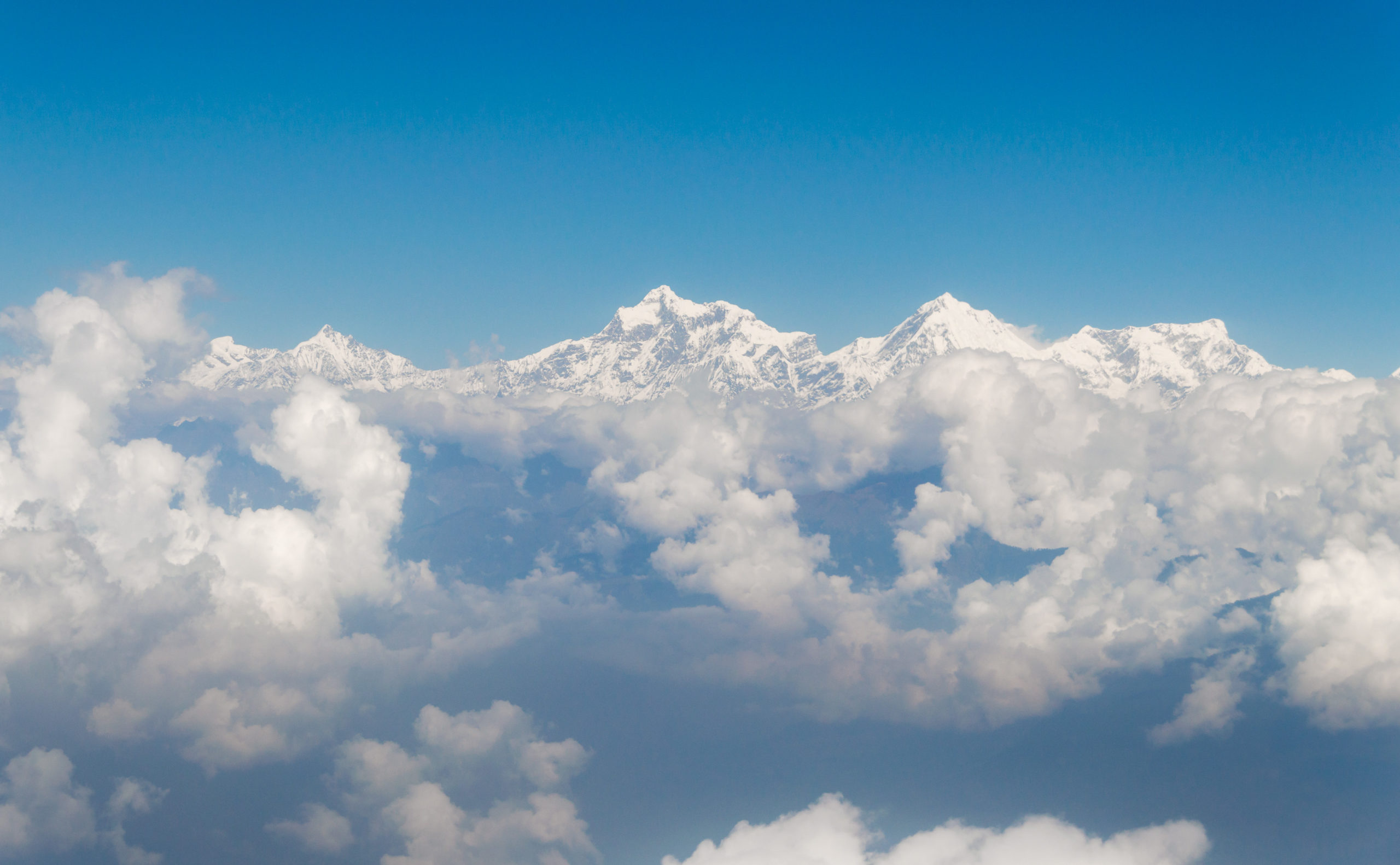
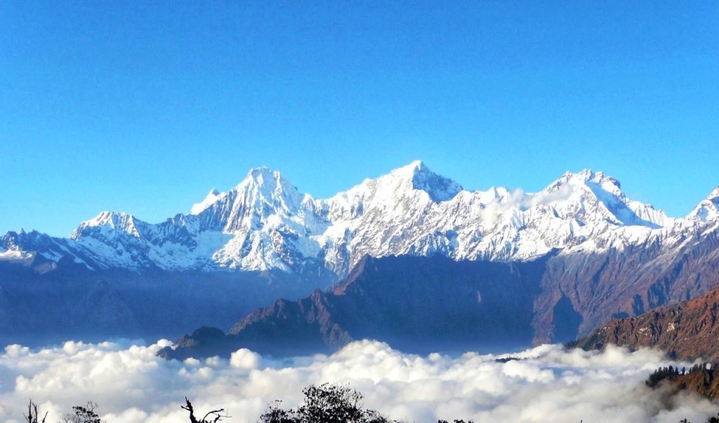
]]>Mt. Makalu resides within the eastern Himalayas range just 19Km southeast of the big Mt. Everest within the border of Nepal and China. Beautiful Arun Valley lies at the bottom of this mountain .This valley facilitates with stunning elevated waterfalls falling inside the deep gorges, diverse species of flora and fauna with rich cultures of ethnic communities like Sherpa and Kirat. Although, this area is somewhat isolated, it’s needless to say that, every visitor who every step here will take a memorable reminiscence with them for his or her lifetime.

Mt Makalu means turned south, while Khempalung means great deity. This is the footsteps of the mountain. The Mt Makalu area belongs to the Makalu-Barun National Park. The government has created the park in 2049 BS by combining hilly geography. Its area is 1,500 sq. Km. Similarly, the intermediate zone is spread over 830 sq km. The height of the park ranges from 435 meters to 8,485 meters. It is bounded on the west by Mount Everest National Park and on the north by Chomolong in Tibet. The park is rich in biodiversity. Herbs are found in the high hills here.
There are Bhote, Rai, Sherpa and other castes living in the park area. Tourists travel by car from Tumlingtar Airport (457 m) to Num and from Num to Makalu Base Camp (5,000 m).After trekking through Num, Seduwa, Tasigaun, Khongma Danda, Dobate, Yanglekharka and Langma, they stay at Makalu Base Camp.
Makaul Expedition

The first attack on Mt Makalu was made in the spring of 1954 by an American team led by Riley Keegan. The expedition was made up of members of the Sien Club, including members from California, including Alan Steak, and was called the Makalu California Himalayan Expedition.They attempted a south-east ridge, but were repulsed by a barrage of hurricanes at a distance of 7,100 meters. A New Zealand team, including Sir Edmund Hillary, was also active in the spring, but not too much due to injury and illness. In the fall of 1954, a French reconnaissance expedition made the first ascent of Auxiliary Kangchungtse and Chomo Lonzo.
Mt Makalu was first honored on May 15, 1955, by Jean Cozzi of a French expedition led by Lionel Terra and Jean Franco. Franco, Guido Magnon and Galgen Norbu Sherpa called Jean Bower, Serge Coupe, Pierre Leroux and Andre Vialte the next day, after the 17th. It was an amazing achievement at the time, with a large number of expedition members at the summit, especially at such a difficult peak. Prior to this time, the summit was reached most by members of one to two expeditions, with the rest of the teams providing logistical support before turning around and topping the house. The French team climbed Makalu through the saddle between Mt Makalu and Kangungatse, through the North Face and the North-East Ridge, establishing the standard route. The 1960-61 Silver Hut expedition attempted to climb without oxygen, but two assurances were unsuccessful.
Things to know
Duration:50 days Max.Altitude : 8485m
COUNTRY : Nepal Best season: Autum/Spring
Walking /day :5-6 hrs
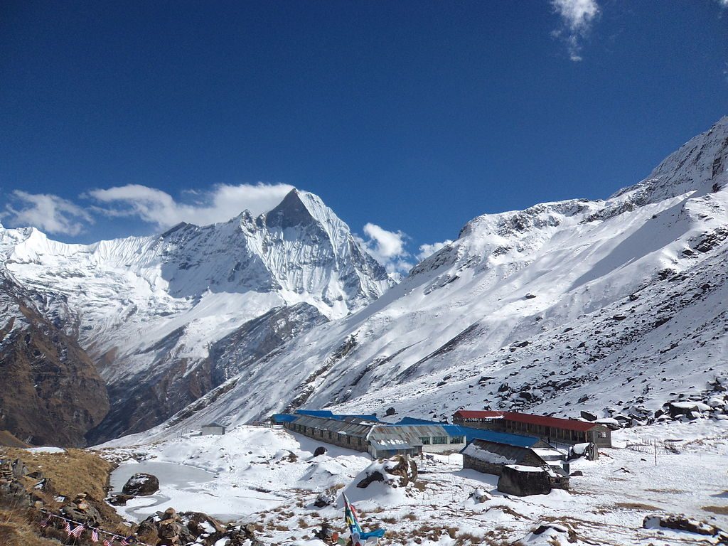
Makalu Base Camp

It takes four days to reach Tumlingtar after returning from base camp. The trek will cross Siptanla Bhanjyang (4,125 m). There is no Sherpa settlement above Tasigaun (2,100 m).
Markhalogyu means turned south, while Khempalung means great deity. This is the footsteps of the mountain.The Mt Makalu area belongs to the Makalu-Barun National Park. The government has created the park in 2049 BS by combining hilly geography. Its area is 1,500 sq. Km. Similarly, the intermediate zone is spread over 830 sq km. The height of the park ranges from 435 meters to 8,485 meters. It is bounded on the west by Mount Everest National Park and on the north by Chomolong in Tibet. The park is rich in biodiversity. Herbs are found in the high hills here.
There are Bhote, Rai, Sherpa and other castes living in the park area. Tourists travel by car from Tumlingtar Airport (457 m) to Num and from Num to Makalu Base Camp (5,000 m).After trekking through Num, Seduwa, Tasigaun, Khongma Danda, Dobate, Yanglekharka and Langma, they stay at Makalu Base Camp.
The park area is of great importance not only in terms of nature, biology and culture, but also in terms of religion. Shivadhara is across the Yanglekharka of the footpath. On the other side of the wall are separate caves named Shiva and Parvati.In Shivadhara, a fair is held on the full moon. Another religious center is Manakamana on the banks of the Arun River near Tumlingtar. September to December is the best time to visit Makalu Base Camp.
How to reach: Kathmandu-Khurkot-Dharan 400 km, bus takes 10 hours. Dharan-Basantapur-Khandbari 185 km, 6 hours by jeep. Or Kathmandu-Tumlingtar 45 minute flight. 4 hours by jeep from Tumlingtar to Num. An 8-day trek from Num takes you to Mt Makalu Base Camp.
Route Description

DAY 1 : Arrive to Hotel & shif in Hotel
DAY 2: REST ,Expedition Preparation in Kathmandu
DAY 3: Fly Ktm -Tumlingtar
DAY 4: Trek (Num to Shedwa )
DAY 5 : Trek (shedwa to Tashi Gaun )
DAY 6 : Acclimatization at Tashi
DAY 7 : Trek ( Tashi to Khongma )
DAY 8 : Khongma to Mumbuk
DAY 9 : Mumbuk to Nehe Kharka
DAY 10 :Nehe Kharka to Mt Makalu Lower base camp
DAY 11: Acclimatization in Lower Base Camp
DAY 12 : Acclimatization in Lower Base Camp
DAY 13: Hike (Lower to Higher Base camp )
DAY 14 to 42 : Climbing Peroid
DAY 43: Return Preperation
DAY 44: Trek(Makalu Base Camp to Yangle Kharka )
DAY 46 :Trek (Khongma to Sheduwa)
DAY 47 : Trek ( Sheduwa to Num ,Drive Khadbari)
DAY 48 :Khadbari to Tumling Tar & Fly Kathmandu
Day 49: Rest In Kathmandu
Day 50 : Final Departure
Suggestions: When you go on a trip to Mt Makalu, you have to prepare well and get good information
FAQ’S
Where is Mt Makalu?
What type of mountain is Mt Makalu?
How long does it take to climb Mt Makalu?
How many people climbed Mt Makalu?
The post MT MAKALU :ALL ABOUT EXPEDITION appeared first on notes Nepal ,kantipur to unicode , kantipur unicode, translate kantipur to unicode, , kantipur to unicode converter, Unicode Preeti to Unicode Convertor,www.preeti to unicode, preeti to nepali unicode, preeti.
]]>The post Annapurna I Mountain : Anonymous Mountain appeared first on notes Nepal ,kantipur to unicode , kantipur unicode, translate kantipur to unicode, , kantipur to unicode converter, Unicode Preeti to Unicode Convertor,www.preeti to unicode, preeti to nepali unicode, preeti.
]]>Annapurna Mountain is part of the Annapurna mountain range from Lamjung Himal to Nilgiri . The Annapurna Conservation Area has been formed under the name of Annapurna Himal, comprising 5 districts of Himal Pari and Himal Wari, the former 57 VDCs. Under the federal structure, Annapurna Conservation Area is now spread in 5 districts, 15 village municipalities and 87 wards of Gandaki.
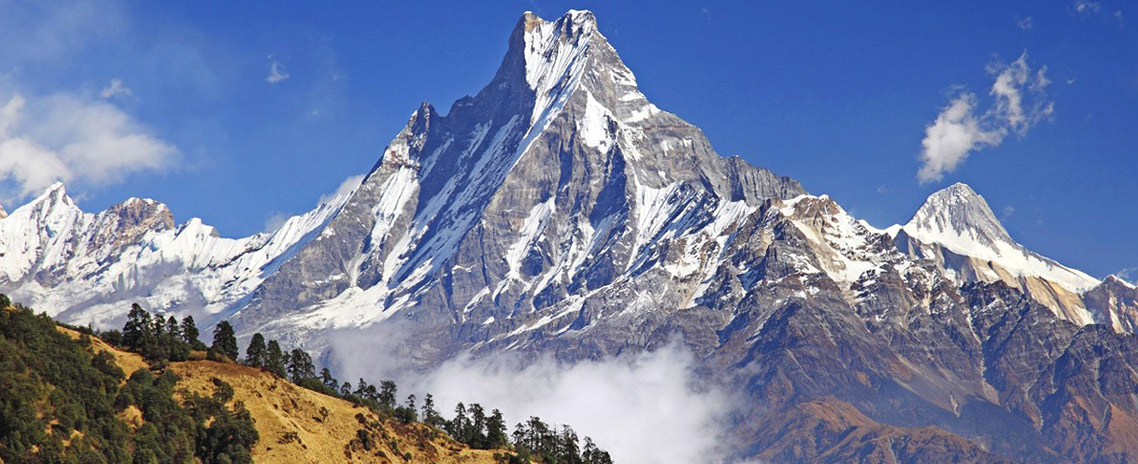
There is a large glacial lake at the head of the Mristi river at Myagdi on the Annapurna cycle path. There is a high mountain in the west-eastern region that casts a shadow over the lake. During the monsoon season, it sometimes snows on the peak. The mountain that looks smiling when the first ray of the morning shines is almost white.There are other mountains nearby, big and small. The highest mountain in the area is known as Annapurna I Mountain (8091 m altitude). Maurice Herzog, a 31-year-old Frenchman, successfully climbed the mountain on June 3, 1950. Annapurna is the first of the 14 mountains higher than 8,000 meters in the world.

The Himalayan group is 55 km 934 miles long, bounded on the west by the Kaligandaki Gorge, on the north and east by the Marsyangdi River, and on the south by the Pokhara Valley. At the western end of this mountain range is a high basin called Annapurna Sanctuary.Annapurna First Mountain is the tenth highest mountain in the world and the ninth highest mountain in Nepal. The height of this mountain is 8,091 meters 926,545 feet.
The entire mountain range and its surrounding 7,629 sq km 92,946 sq mi area is protected by the Annapurna Conservation Area.It is the first and largest conservation area in Nepal. The Annapurna Conservation Area is home to various pedestrians, including the Annapurna Circuit. Historically, Annapurna Mountain is one of the most dangerous mountains in the world to climb.
Annapurna Expedition History

It has been 69 years since the successful ascent. Three years after Annapurna’s first ascent, Mount Everest was successfully climbed. Just as there is government support and investment in the development and prosperity of the Everest region. In comparison, the government’s support for the development and prosperity of the first Annapurna region, which has established its first history, is low. Morris, the first person to climb Annapurna I, had been complaining that the Annapurna region had not developed during his lifetime.
Morris, who came to climb the mountain with the permission of the then Maharaja (Shri 3) Mohan Shamsher (Jabra), wanted to climb Mount Everest. He came to Annapurna after being told by British George Hunt and Sir Edmund Hillary, “We are climbing, you choose another mountain.” The British who were trying for the 12th time could not climb Mt. Everest.After the British citizen Sir George Everest measured the height of Mount Everest and discovered the highest mountain in the world, the British did not allow others to climb Mt. Everest. They were trying to make history themselves. When the British were not allowed to enter Nepal, they measured Nepal’s mountains from India.
Morris, who came to Dhaulagiri near Annapurna area, climbed Annapurna first from Tukuche area of Mustang on the side of Kaligandaki, leaving Nilgiri Himal behind. He set a world record by hoisting the French flag on the 8,091-meter peak. Maurice Herzog was the first person in the history of the world to climb more than 8,000 meters.”If we had gone to climb Mt. Everest, it would have been like betraying them,” says Morris in his book, The First Step to Annapurna.

‘The British were making their twelfth attempt to climb Mount Everest. They were even training to climb Mt. Everest. The British George Hunt and Edmund Hillary were my friends, ‘says Morris in the book. This time you have a chance to leave for us once, this time you can’t, next time we will climb, saying we will go to Annapurna Arohan. ‘
Morris’s team flew from France to Delhi and traveled from India to the Nepal border by road. They had reached Dhaulagiri area via Lumbini and Baglung. Morris’s team consisted of 250 porters. He had come to climb the 8,167-meter-high Dhaulagiri mountain after he could not climb Mt. Everest. Following the locals’ suggestion that it is not appropriate to climb Dhaulagiri now, he focused on climbing the first Annapurna mountain in the east.Morris had informed the people of Narchang during his visit to Nepal that he had succeeded in climbing the Annapurna First Mountain just as the monsoon was about to begin and avalanches were falling.
News that he had climbed Annapurna Himal spread all over the world. “After we climbed Annapurna, the French went to a mountain 8,000 meters high, hoisted the French flag on the mountain, how did they climb that mountain, who are they?” That caused a stir all over the world. It is mentioned in his book that the eyes of people all over the world have been opened that even the highest mountains of Nepal can be climbed. After the first ascent of more than 8,000 mountains, the world’s attention was focused on Nepal.A three-day national festival was held in France at that time to celebrate the world record of the first climber to climb Annapurna.
Herzog, who lost both his legs and both hands during the first Annapurna mountain climb, was carried down by his allies. He was accompanied by Louis Lachenel. On his return, he was informed that Mohan Shamsher had sent a letter to meet him. In a grand ceremony at the palace, the then government awarded him the Gurkha Cross (La Khwa da La Ger) medal.Morris states in his book that he was the only foreigner to receive the medal. The book is thought to have sold more than 11 million copies before 2000. The book, titled “Lannapurna Fermi Ui Mill” in French, is said to have sold more than the Christian Bible in the United States. This book is probably the best-selling book about Nepal in the world. Morris wrote the book in 1951 while undergoing treatment in a Paris hospital.

Morris, who was unmarried, wondered what would happen if he climbed the mountain. Unable to get good treatment in Nepal and India, he spent some time in France and a long time in the United States. Morris, who had been using artificial limbs, died on December 13, 2008 at the age of 93. Before climbing Annapurna, he had climbed mountains in Europe and South America at an altitude of 4,800 meters.
Nepal is becoming a center of attraction for mountain tourism with the successful ascent of Annapurna Himal. ‘Annapurna is much more difficult to climb than Mount Everest. Despite getting the title of Jetho Himal, many tourists are still unable to reach Annapurna Pratham Himal. The trekking route is being expanded. A trekking route has been constructed up to the mountain. Now it is expected to be comfortable.
He is of the view that the ascent of Annapurna I has become a low priority as everyone who climbs the mountain chooses the highest peak, Mount Everest. ‘Annapurna I has its own significance. It has not been publicized yet. The management of the trekking route is the biggest challenge .Annapurna Himal is one of the first and largest conservation areas in Nepal.
“It simply came to our notice then. After Maurice first climbed Annapurna in 1950, tourists began to take an interest in the area, ‘he said. According to Gurung, the Annapurna Himal and the surrounding area of 7,629 square kilometers have been protected through the Annapurna Conservation Area Project.
Lamjung is part of the Annapurna mountain range from Himal to Nilgiri. The Annapurna Conservation Area has been formed under the name of Annapurna Himal, comprising 5 districts of Himal Pari and Himal Wari, the former 57 VDCs.Under the federal structure, Annapurna Conservation Area is now spread in 5 districts, 15 village municipalities and 87 wards of Gandaki. The Annapurna Conservation Area was started as a test from Ghandruk in Kaski in 2043 BS. About 200,000 tourists visit the Annapurna region every year. Among them, the number of tourists from France is in the top five, according to ECAP.

Maurice Herzog, who introduced Nepal and Annapurna to the world, is hardly remembered by the public and private sectors. Occasionally there are formal events in the Annapurna region. According to Tej Bahadur Gurung, chairman of the Conservation Area Management Committee Narchang (Annapurna Village Municipality 4, Myagdi) formed by the Annapurna Conservation Area Project (ACAP), Morris visited Nepal 30 times after climbing the mountain.Morris, who last visited Narchang in 2005, complained that the government was not interested in the development of Annapurna I, no matter what he said. ‘I don’t have to remember. “I said it was enough to develop the mountain and the region,” Gurung said, referring to Morris. “He is not remembered by the state and the government.” What can we do? ‘
A statue has been erected in memory of Morris at Annapurna base camp in Annapurna village of Kaski district. The people of Myagdi have complained that the road he was walking on has not been developed due to the publicity from Morris Kaski. After Annapurna Himal and Annapurna Base Camp, everyone’s attention was focused only on Kaski. No one paid attention to the way Morris walked and the mountain he climbed, If the footpath to Annapurna I is good, organized and safe, tourist arrivals will increase.
Trek Route to Annapurna I.
A footpath has been constructed up to the base camp to reach Annapurna I. According to Pun, the footpath has been open since last year and tourists have started coming. According to Narchang leader Subash BK, there is a 24 km road from Beni to Narchang.The Nilgiri Hydropower Project has constructed a road at a distance of 16 km from Narchang to Chhotepa. The project is preparing to build about 9 kilometers of road from Chhote Pada to Humkhola. From Humkhola, it takes about 6 hours to reach Bhusket and from Bhusket, it takes about 5 hours to reach Annapurna Wes Camp from 4,100 to 4,400 meters.
Struggle for hiking
The footpath passing through Tukuche and Taklung of Mustang is very scary. According to the locals, they used to fall down the cliff and die on the way. The road from Narchang to the base camp is also scary. However, the hydropower project is constructing a road to cut through the area. Chairman Gurung said that he was called ‘crazy’ while constructing the footpath. According to him, there was no footpath from Narchang to Annapurna I base camp. ‘The study was conducted in 2067 under my leadership.Locals are able to open a footpath on the other side of the Mristi River to the mouth of the river. A proposal for the construction of the footpath was written in 2068 BS and submitted to the Ministry of Tourism. In 073 and 074, 15/15 thousand and 75 million 2 million was received, while last year 1.5 million and now 1 million has been given by ECAP. The Gandaki state government has sanctioned Rs 1.5 million this year. The ward has provided Rs 300,000. “We are building footpaths. We have made a place to live.

Locals have built suspension pools at Mristi Khola-2 and wooden fences at many places.The footpath from Kaski to the lap of Annapurna Himal and the base camp are in th..e shadow of the base camp of Myagdi. Even if you can go from Kaski to the base camp, you can’t climb the mountain. To climb the mountain, you have to come to Annapurna, the first base camp in Myagdi. Even though tourists have been visiting the base camp in Kaski for years, they have been visiting the Annapurna base camp in Myagdi only since last year.The construction of infrastructure in the area has been delayed due to lack of human settlement and forest cover above Narchang. High mountain scenery, lakes, various flora and fauna can be observed while trekking in this area.
Have to Depend on Helicopter
Since there is no footpath to reach Annapurna I and the existing footpath is also at high risk, tourists who climb and climb the mountain reach there by helicopter. The British troops who made their first ascent to Annapurna on April 23 had flown to Nirmal Purja base camp in Myagdi by helicopter. He is the first local to climb over 8,000 mountains in the area. Pun is known to the British Army as the Snow Leopard. Those who go to Annapurna I for the first time or use the helicopter. Helicopters have reached Annapurna base camp more than 20 times this year alone. According to Nepali Wikipedia, the number of people who climbed Annapurna for the first time in 2012 is 191.
FAQ’S
The post Annapurna I Mountain : Anonymous Mountain appeared first on notes Nepal ,kantipur to unicode , kantipur unicode, translate kantipur to unicode, , kantipur to unicode converter, Unicode Preeti to Unicode Convertor,www.preeti to unicode, preeti to nepali unicode, preeti.
]]>The post Mt. Mardi Trek : Mardi Mountain known by foreigners before Nepalis! appeared first on notes Nepal ,kantipur to unicode , kantipur unicode, translate kantipur to unicode, , kantipur to unicode converter, Unicode Preeti to Unicode Convertor,www.preeti to unicode, preeti to nepali unicode, preeti.
]]>Mardi Himal Trek is a short-term adventure destination. It is also a mountain known to foreigners before Nepalis. The trekking has started as an alternative route after many trekking routes in Annapurna area fell on the Chepuwa of the road. The trekking route was identified and promoted before 2011 with the help of Annapurna Conservation Area Project (ACAP) and Trekking Agencies Association of Nepal (TAN) Western Chapter and locals.

The main feature of this Mardi Trek is to be able to walk at an altitude of four thousand six hundred meters in a short period of time.
From Pokhara, one can reach Pothana, Pitam Deurali, Kokar (Forest Camp), Humal (Low Camp), High Camp, Siding and Mardi Bridge and return to Pokhara. Mainly Gurungs, Tamangs, Vahuns, Kshatriyas and Dalits live in this area. Interviews with Tamang culture can be done in Siding. The Mardi Himal trek can be completed in a week from Pokhara.
The trekking in the area was calm, clean and gave a new experience as very few people walked there. Traditional villages, Pokhara can be seen at close range, Machhapuchche and Dhaulagiri can be seen from many mountains, Laligura and wild animals and birds including scarecrows are present on this route. Sheep and buffalo rearing can be seen even at an altitude of over 4,000 meters under this trekking route.Mardi Trek

Mardi Himal Trek is a short-term adventure destination. It is also a mountain known to foreigners before Nepalis. The trekking has started as an alternative route after many trekking routes in Annapurna area fell on the Chepuwa of the road. The trekking route was identified and promoted before 2011 with the help of Annapurna Conservation Area Project (ACAP) and Trekking Agencies Association of Nepal (TAN) Western Chapter and locals.
The main feature of this route is to be able to walk at an altitude of four thousand six hundred meters in a short period of time.
From Pokhara, one can reach Pothana, Pitam Deurali, Kokar (Forest Camp), Humal (Low Camp), High Camp, Siding and Mardi Bridge and return to Pokhara. Mainly Gurungs, Tamangs, Vahuns, Kshatriyas and Dalits live in this area. Interviews with Tamang culture can be done in Siding. The Mardi Himal trek can be completed in a week from Pokhara.
The Mardi Himal trek has been popular lately as it is attractive, beautiful and adventurous, full of biodiversity and natural beauty. Months like Chait, Vaishakh, Mansir, Pus and Magh are considered good for this trek. He said that this trekking route has become the best option to prolong the stay of tourists coming to Pokhara for a few days. Mardi Trek.
From the place where the trek starts, you can see different types of flowers including Guran in the spring. The beauty of the blooming flowers and the chirping of the birds make the atmosphere very modest. Especially when you start the journey, especially at this time, you can see the pink gurans, but when you go up the hill, you get dark red gurans. They like to go on this trip.

As it is difficult to reach the Mardi base camp at 45,000 meters in this season, it is better for non-experienced travelers to travel to the viewpoint or highpoint (3550 meters) at 42,000 meters. Once there, the stumbling blocks in front of your eyes can be exhausting. This trek can be a ‘conscious choice’ for travelers who want to get close to the mountains on the third morning of their journey.
The trekking route to Annapurna base camp, Ghandruk-Ghorepani trek, Machhapuchche model trek and seven districts of western Nepal can also be seen. The area, which used to have an organized camping trek, has recently included a tea house trek with accommodation.
The high camp at the foot of Mardi Himal Trek, which is 5,587 meters high, is at an altitude of 4,100 meters. From here the hikers hike up to an additional five hundred meters.
Mesi Mardi became famous in the West in 1953 when the British citizen Vassil Goodfellow took a picture of Mount Mardi. Jimmy Roberts, along with two Sherpas, climbed the mountain for the first time in 1961, eight years later. A Japanese national lost his life while trekking in Mardi Himal Trek . Earlier, a student studying at Manipal Kajal died during the same journey.
On the first night of the trip, most people choose low camp (2970 m) to stay. The largest fish tail can be seen from the low camp. Cheap accommodation is available at all the hotels on the way from here to High Camp. The ‘menu’ for both locals and foreigners seems to be relatively expensive. For those traveling through Kaski’s Dhampus or Kaande, the trek from Siding, known as Kaski’s last village, is short and easy. The jeep reaches Pokhara in two hours from Siding.
Mardi Himal Trek is a short-term adventure destination. It is also a mountain known to foreigners before Nepalis. The trekking has started as an alternative route after many trekking routes in Annapurna area fell on the Chepuwa of the road. The trekking route was identified and promoted before 2011 with the help of Annapurna Conservation Area Project (ACAP) and Trekking Agencies Association of Nepal (TAN) Western Chapter and locals.
A mountain range standing in front of the eyes as if it could be held by hand. It is a pleasure to see the snow-capped white mountains, green forests, beautiful hills and settlements. Such an opportunity is available only to those who trek to Mardi Himal.
More than half a dozen mountains including Mardi, Annapurna South, Himachuli, Annapurna I, Gangapurna and Gandharva Chuli, including Kumari Machhapuchhe, can be seen from the same trip.
The number of people marching in different organizations and groups is the same now. The Ultra Marathon World Cup held here two months ago has also made it known in the international arena. Due to the lack of access to road transport so far, it has become the choice of internal and external tourists.
It has been developed as a Mardi Himal Trek trekking route as the base camp of Mardi Himal near Kumari Machhapuchhe can be reached without climbing till now. Kalimati and Siding can be reached by jeepney through Ghalel of Machhapuchhe village municipality which is 22 km away from Pokhara. From there, you can climb the hill through the forest and reach the low camp located at an altitude of 2,970 meters.
Tourists reach Low Camp via Pothana, Australian Camp, Pritam Deurali and Forest Camp from Machhapuchhe’s Dhampus and Annapurna. From Low Camp, you can reach Mardi Himal Base Camp at an altitude of 4,500 meters via Badaldanda, High Camp and View Point.Mardi Trek
From the view point, you can see more than half a dozen mountains, including the Pokhara Valley.

Most of the tourists reach Mardi Himal Base Camp and return to Pokhara via Ghalel, Canoning and Lwang, known as the Tea Village.
Five or six years ago, this route was anonymous. It is difficult to keep tourists even in the main season during the last two-three years due to the difficulty of seeing tourists, while the number of tourists is high even at other times. The number of Nepalis is the same as that of foreigners.
With the increase in the number of tourists, except for those who have already booked in advance, others have been suffering due to lack of adequate infrastructure in the main season.
Shiva Prasad Bhandari, a member of the Mountaineering Management Committee, which has been operating Mardi Himal Eco Village in Machhapuchhe Gaonpalika-8, Kalimati for the past five years, says that the tourist crowd can be stopped in the main season for the last two years.
It is believed that new hotels and restaurants are being added in other places along the trekking route. It attracts young and old alike, even for short distances. As it can be completed in a short period of time, it has attracted even those who have a busy diary. Some tourists reach Kalimati in a jeep and return from there after seeing the scenery of the mountain range.The tourism entrepreneurs have demanded that Mardi Himal should be developed as a trekking route at a time when the popular trekking routes including Annapurna, Ghandruk and Ghorepani are causing inconvenience to the pedestrians.
FAQ’S
How long is Mardi Himal trek?
How difficult is Mardi Himal trek?
How can I go to Mardi Himal?
How much does the Annapurna trek cost?
The post Mt. Mardi Trek : Mardi Mountain known by foreigners before Nepalis! appeared first on notes Nepal ,kantipur to unicode , kantipur unicode, translate kantipur to unicode, , kantipur to unicode converter, Unicode Preeti to Unicode Convertor,www.preeti to unicode, preeti to nepali unicode, preeti.
]]>The post Mt.Dhaulagiri :Glory of Nepal appeared first on notes Nepal ,kantipur to unicode , kantipur unicode, translate kantipur to unicode, , kantipur to unicode converter, Unicode Preeti to Unicode Convertor,www.preeti to unicode, preeti to nepali unicode, preeti.
]]>Dhaulagiri literally means “white mountain”.It is the seventh highest mountain in the world which is 8167 m above the sea level.It is located on the eastern side of the this mountain range, which lies in the central part of the Nepali Himalayas. It is located northwest of Pokhara. To its east lies the Annapurna Himal on the other side of the deep gorge of Kali Gandaki, the first of which is over 8,000 meters high. 
DhaulagiriDhaulagiri (8,167 m) was the highest peak in the world before the heights of Kanchenjunga and Everest were determined. It is currently ranked seventh in the height classification. However, mountains should not be measured by height alone. Mountains should be valued in a multidimensional way. The current challenges of mountaineering, the topography of the topography, the geographical and geological significance, the characteristics of the biodiversity as well as the cultural originality of the Dhaulagiri mountain has not been able to climb.
Dhaulagiri Expedition

Why don’t our world-famous climbers, who are ready to climb Mt. Everest for the twentieth time, do not climb other mountains? The history of mountaineering shows that the challenge of mountaineering is even greater in Dhaulagiri. About 40 percent of the climbers who have gone to Dhaulagiri to date have lost their lives.
After Maurice Herzag’s attempt to climb failed in 1950, he headed for Annapurna. Only 10 years later, in 1960, Swiss and Austrian teammates Kurt Dimeberger, Peter Diner, Ernst Forrer, Alvin Shelvert, Neema Dorje and Ngawang Dorje successfully climbed Dhaulagiri. Since then, in the 49-year history till 2009, only 413 climbers have reached the summit of Dhaulagiri. On the other hand, 347 people have climbed Mt. Everest in the spring of this year.

In order to reduce the burden of human footsteps and pollution on Mt. Everest, it is logical to attract mountaineering enthusiasts to other peaks. For that, it has to be established that It is an important and challenging destination. Accordingly, it is important to think about the management of infrastructure in time. The fact that the mountain of challenge is Dhaulagiri is in dire need of publicity in the world of mountaineering.
Unique location

In May and July 1966, Dhaulagiri was given a chance to explore the flora and fauna. At that time, crossed Jangla Bhanjyang (4420 m) from Pokhara via Dhorpatan, Dunai of Dolpa (1676 m) and then Foksumdo Lake, She-Gompa, Tarapagaun, Charkabhot, Sangda Bhanjyang (5487 m) and returned to Pokhara via Kagweni. The visit provided an opportunity to learn about the importance of Dhaulagiri, especially in the field of flora and biodiversity.
It can be circumnavigated from Nepal’s land, not Tibet. The Himalayas stretch from the Indus River valley in the west to the Brahmaputra valley in the east, with a length of approximately 2,500 km. There is heavy rain in the eastern mountains. Cherrapunji (1326 m), located at an altitude of Kathmandu, receives an average of 11,615 mm of water in each monsoon, seven times more than Kathmandu and almost three times more than Pokhara.

In the western Himalayas, there is no such monsoon.There are snowfalls, also in the form of snow. The eastern mountain ranges lean south toward the equator, while the western mountain ranges farther north. For example, the latitude of Mount Everest is about 28 degrees, while Nanga Parbat is about 35 degrees. Due to that, there is a lot of difference in the environment and biodiversity of the eastern and western mountains.
Confluence of biodiversity

As they spread from east to west and from west to east, these differences and variations are met in Dhaulagiri and Kaligandaki of Nepal. It is customary to call the mountains east of Kaligand the eastern mountains and the western mountains the western mountains. Dhaulagiri peak is located at 83 degrees east longitude. With the help of this line, botanists separate the eastern and western botanical provinces. Dhaulagiri also connects Dolpa in the north, Mustang Desert region and Myagdi-Parbat and Kaski region in the south.
In this sense, Dhaulagiri and the Kaligandaki region at its base have served as a crossroads for biodiversity and the environment. This means that the region serves as the center of East-West and North-South Asia.The broad-leaved Gurans, Chap, Kaulo, Arkhaulo, Katus, Chilaune, etc., which reflect the characteristics of the eastern mountains, and their forests extend to the Gandak region, cannot extend to Karnali. In fact, it does not extend west of Dhaulagiri.
Dhaulagiri-Annapurna and Kaligandaki also appear as similar confluence areas for birds and other creatures. In the eastern Himalayas, Chilimechara, Khong can be seen only up to Dhaulagiri. When they go west, they are not visible. Similarly, chickpeas, chiropractors and cockles (Cockcross phegants) are abundant in the west, but are not often found in the east.
Underground mirror

Dhaulagiri, Annapurna and Kaligandaki also have many other special originals. When you cut down the Sangda Bhanjyang (5487 m) that falls from Dolpa to Kaligand, you can see that it has reached the deepest valley in the world. After all, Dhaulagiri on one side and Annapurna on the other are both 8000 m high and Kaligandaki flows at an altitude of about 3000 m in the middle.
In this regard, 5000 min. As the width of the deep valley is only 35 km wide, it is one of the most amazing landscapes in the world.
Surprisingly, the Shaligram rocks found in Kaligandaki preserve the remains of all the shellfish found at the bottom of the sea. The discovery of the method or science of how the bottom of the sea reached the sea is also exciting in itself. Scientists estimate that Shaligram is 200 million years old.Geological evidence of the origin and formation of the Himalayas and its mirrors can be easily seen in the Kaligandaki valley. This is a unique laboratory, a school, about the construction and origin of the mountain.
Dhaulagiri in provincial Nepal

Dhaulagiri Zone is formed by carrying the name of Dhaulagiri Mountain, which includes Mustang, Myagdi, Baglung and Parbat four districts. Gandaki and Lumbini zones have been added to the Dhaulagiri zone to form the Western Development Region. This development area includes Terai and Madhes, hills and mountains and Bhote Pradesh. In the context of the state restructuring of the Republic of Nepal, it is also a matter of time before the geographical and natural diversity strengthens the interconnectedness of stone-to-soil and soil-to-stone.
Does it connect or separate ‘Tamuwan’ and ‘Magarat’? This is a serious question. If we make the point of adjustment the center of division, no positive result can be expected from it. Dhaulagiri needs a hand to lift it, not a fist. The complementary nature provided by the form of the Western Development Region created by Dhaulagiri, Annapurna and Kaligandaki has to be strengthened by integration and not by division. New Nepal is where the Terai and Madhes lift the mountains and the mountains lift the mountains.The new Nepal is the one where the vote removes the shortcomings of the mountains, the mountains the mountains and the mountains the Madhes and the Terai. To lift it, the hands of Terai, Madhes, hills, mountains and Bhota should be mobilized.
FAQ’S
Where is Dhaulagiri?
How to reach Dhaulagiri?
Bhaitika Saait 2077 : The Auspicious Occasion and Time for Bhaitika 2077
The post Mt.Dhaulagiri :Glory of Nepal appeared first on notes Nepal ,kantipur to unicode , kantipur unicode, translate kantipur to unicode, , kantipur to unicode converter, Unicode Preeti to Unicode Convertor,www.preeti to unicode, preeti to nepali unicode, preeti.
]]>The post Ganesh Himal : Angel Of Mountains appeared first on notes Nepal ,kantipur to unicode , kantipur unicode, translate kantipur to unicode, , kantipur to unicode converter, Unicode Preeti to Unicode Convertor,www.preeti to unicode, preeti to nepali unicode, preeti.
]]>Ganesh Himal lies in the North Central of Nepal seperate it from Langtang by Trishuli Gandaki Valley in East ,Budhi Gandaki &Shyar Khola in West from Shringi Himal &Mansiri Himal .It lies in the North -West of Kathmandu which is 70km range from Kathmandu .The mountain is named after the name of hindu God Ganesh whose face is depicted like elephant . It is located in the boarder of China and Nepal .
Ganesh Himal is suitable for cultural immersion along side natural bewilderment to feast the eyes where guest would be accommodated reception stay sharing the space with host family and having taste of the local meal prepared by relations of the house stay organically and delving the way of lifetime of the local inhabitants. Elevation of this mountain is 7429 m .Difficulty for expedition is Major Mountain Expedition.The Best months to climb: April, May, September, October .Its Convenient center lies in Kathmandu, Nepal.
Ganesh Himal is an area of great potential for Nepal. First of all, it is close to Kathmandu, on the other hand, it is known as a region of great potential from both natural and cultural point of view. Nearby are the Langtang area and the Tamang Heritage. On the other hand, this area is also considered very important from a religious point of view.
The most important thing is that it has the most minerals in the region, so it is very important,the Ganga Jamuna Lake and the four districts of Dhading, Nuwakot, Rasuwa and Gorkha could be developed, it could be taken as an alternative to Everest and Annapurna.
Ganesh Himal Expedition
Ganesh himal expedition is Unique Path adventure , Expedition at 7, 422 meters / 24, 350 ft high summit, this mountaineering climb leads to one of the world’s best trekking destination in the awesome Ganesh Himal area west of Langtang and east to worlds highest Mt. Manaslu range with fabulous scenery everyday during the trek and climb of Ganesh Himal also known as Yangra. The highest peak within the range is Ganesh I (Yangra) at, 7,422 m /24,350 ft high, there are three other peaks over 7000 meters and with 14 others over 6,000 meters within its massive range, the primary successful climb was by a Franco-Swiss Expedition team via the Southeast Ridge in 1955.
Unique Path adventure to Ganesh Himal Expedition results in awesome picturesque country within the heart of giant bulk of Ganesh Himal range of mountains within high country and thru Tamang Heritage Trail.
Gaensh Himal climb is technical includes ice and hiking in most of the places till to the summit top, offering grandeur view of surrounding peaks and shut view of the Tibetan plateau. This range lies on the Tibetan border line.
The climb is high technically, should be conversant in the utilization of your equipment, crampons, harness, ice axe, tying knots and handling climbing ropes. Most of the Ganesh Himal Expedition are going to be involved walking roped together, including the glacial crossings. this is often adventure to Ganesh Himal for the experience mountaineers who have done previous climb within the Himalaya and in Alps mountains.
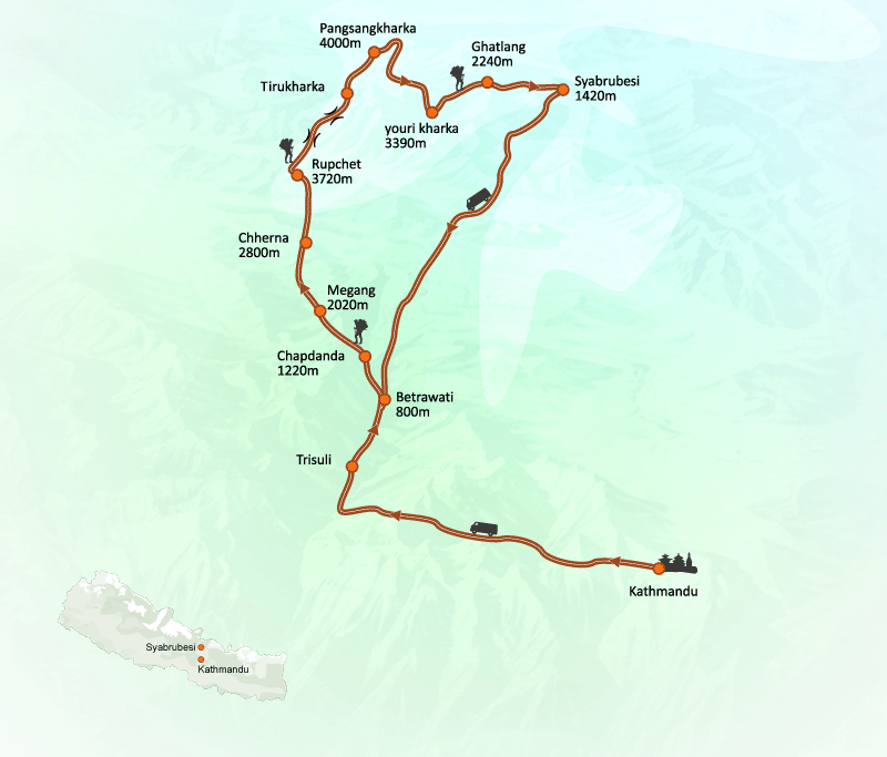
Starting this excellent adventure with a stimulating drive overland to Syabrubesi for Ganesh Himal Expeditions with quite six hours journey to Syabrubesi, door to Langtang valley, Ganesh Himal and to Tibet border, from Syabrubesi towards North West past traditional and cultural Tamang villages of farm lands to its Base Camp.
Climb is far technical on snow and ice fields for a few time then heading towards the highest summit where our expert guides will maintain the route fixing ropes and snow bar where necessary in some technical sections on route to the highest . After a vigorous climb reaching the summit of Ganesh Himal with fabulous views of surrounding high mountains in the far west Annapurna, Manaslu and adjoin peaks of it with Langtang to North East Jugal Himal range and extending towards Dorji Lakpa to Mt. Gaurishanker, Melungatse, Phubagyache in the far eastern horizon and of Tibetan plateau towards North.
Leaving the last human settlement and villages for complete wilderness heading to higher region through enchanting rhododendron, pines and oaks forest towards wild country within the harmony of high mountains and nature leading at moraine and ice with rocks and boulders to determine its Expedition base camp, high camp and beyond further two more camps before the summit bid of Ganesh Himal at 7, 422 meters high, at the bottom camp and high camp with proper rest and acclimatization for the large day and therefore the highlight of this adventure.
After an excellent time within the hidden areas of upper Ganesh Himal area heading back to Syabrubesi village within the comfort of cozy lodge after camping nights on climbing period then a repel to Kathmandu after a successful hard Ganesh Himal Expedition with grand service of Unique Path and its cheerful team of staff and guides.
Ganesh Himal Route
The Ganesh Himal region is very important from a natural and cultural point of view and can be developed as a suitable tourist trail,The area can be expanded to four routes that can be selected based on the time and choice of the tourist. 120 lbs. I There are different routes in this area from 1 week, 2 weeks to 18 days, 3 weeks to 25 days. Earlier, there were serious allegations of security threats in the area.
Why is not tourism promoted here ?
Despite the abundant potential for tourist attractions, the lack of public awareness among the locals is considered to be the main reason for the lack of tourism management in this region. Although the area has been in the news for a long time, many have complained that tourism has not been able to flourish due to lack of necessary support from the local people and political parties.
Places To Visit Near Ganesh Himal
Pangsang Bhanjyang
Pangsang Bhanjyang, the last Tipling VDC in the northernmost part of Dhading’s Ganesh Himal, which is close to the Chinese border, is a place of historical significance and scenic beauty.Although Pangsang Bhanjyang is located on the slopes of the upper hills or on the coast, it is located in the plains. Here, cedar, red grass, green grass, and many colorful flowers are blooming. Tourists coming to Ganesh Himal do not leave this Pangsang. Reserved markets of Rasuwa and Nuwakot Trishuli can be seen from this area.
Singla
Singla of Jharlang VDC has been considered as a religious place by the locals since time immemorial. Many years ago, when Tamang Gothal was staying in a place called Manchyat, a miraculous disciple in a night dream told him to worship the lake with devotion every year. From that time onwards, the pilgrimage takes place on the full moon of August every year.Jhankris have an important place in this procession. At that time, new jhankris are given wangur from which jhankris are believed to be very perfect, capable, and strong. Jhankris from different villages of Rasuwa and Nuwakot also play dhyangro and sing and dance in sweet rhythm.
This is especially true for young people. The disciples prepare and take with them a variety of desserts. Similarly, the new jhankri and the brothers involved in the procession are distributed. The brothers also pay according to their means. This Singladevi is a very beautiful and charming place. From this area you can see the skyscrapers Ganesh Himal, Lamtang Himal, Pyaldor Himal to the plains and Lekali fields and meadows. The unique flowers of this lake make the tourists happy.Many foreign tourists visit Singla every year to see the beautiful scenery. Tourists return to Kathmandu from Sertung village after a 6-hour panoramic view.
FAQ’S
Where do Ganesh Himal lies ?
list of Climbing history of Ganesh himal?
How far is Ganesh Himal from Kathmandu ?
Is Ganesh Himal is in Nepal or China ?
The post Ganesh Himal : Angel Of Mountains appeared first on notes Nepal ,kantipur to unicode , kantipur unicode, translate kantipur to unicode, , kantipur to unicode converter, Unicode Preeti to Unicode Convertor,www.preeti to unicode, preeti to nepali unicode, preeti.
]]>The post Mt Macchapuchhere :Is it Opened for climbing ? know it . appeared first on notes Nepal ,kantipur to unicode , kantipur unicode, translate kantipur to unicode, , kantipur to unicode converter, Unicode Preeti to Unicode Convertor,www.preeti to unicode, preeti to nepali unicode, preeti.
]]>As Machhapuchhre Himal is the symbol of the head of a Hindu deity, it is believed that one should not climb it Machhapucchrere is a head, not a fish tail. That mountain peak is a symbol of ascetics named ‘Nar ‘and ‘Narayan’. Therefore, human footsteps should not be placed on the heads of ‘Nar’ and ‘Narayan’The beautiful Machhapuchhre Mountain, which casts a shadow in the Fewatal of Pokhara in Kaski, is not open for mountaineering.

Of course, the attempt to climb it had already taken place 61 years ago.In 1957, British mountaineer Jimmy Roberts reached a height of 6,993 meters, just below the peak of the fish tail, experts say.but no one has not climbed the mountain since then
Gurung ,Magar consider and worship it as an idol of Lord Shiva .The villagers told the government not to allow them to climb because they did not want to trample on God or litter. The government also obeyed the order. The then King Mahendra Bir Bikram Shah listened to the request of the villagers and asked them to stop the ascent.In the meantime, some foreign climbers tried to climb the mountain, but many did not give good news.
If Machhapuchhre Himal opens, the door of prosperity will open in the villages and settlements below Machhapuchhre Himal.
Status
Mt. Machhapuchhre, at the bottom of a long inspiring range, extends outwards from the south to the main part of Annapurna, giving the eastern border the form of Annapurna Conservation Area. This protected area is a favorite trekking destination of tourists and the base camp and other natural scenery from the south side of Annapurna is very captivating. This picturesque peak is about 25 kilometers from the main city Pokhara.
Naming
The name of this mountain is Machhapuchhre because it is like the tail of a fish. It is also called fish tail in English. It is called Katasu Kliko in Tamu language.
Preparations have started to open Machhapuchhre Himal (6993 m) located in Machhapuchhre village municipality of Kaski for climbing. The Department of Tourism has started the process after conducting further study on the basis of the letter sent to the Ministry of Tourism by the village municipality after passing the decision from the meeting of the village executive committee.
Now climb for development and prosperity :
The locals will benefit from the opening of Machhapuchhre. “Tourism is the mainstay of our economic prosperity.Even now, foreign and domestic tourists do not come to this region. However, as the current activities alone will not bring economic prosperity here, request in writing to open mountaineering and has been sent to government The reply has been positive.
The villagers are not happy.
If this is not good, then you are anti-development,” said a local from here, speaking on condition of anonymity. “What happens to the people here when this mountain is opened?” Only a limited number of people are obese. You have to know how to please God. The current work is not for the benefit of anyone other than the village head and the tourism businessman. ‘The villagers are not happy. “If this is not good, then you are anti-development,” said a local from Machhapuchhre, speaking on condition of anonymity. “What happens to the people here when this mountain is opened?” Only a limited number of people are obese. You have to know how to please God. The current work is not for the benefit of anyone other than the village head and the tourism businessman. ‘
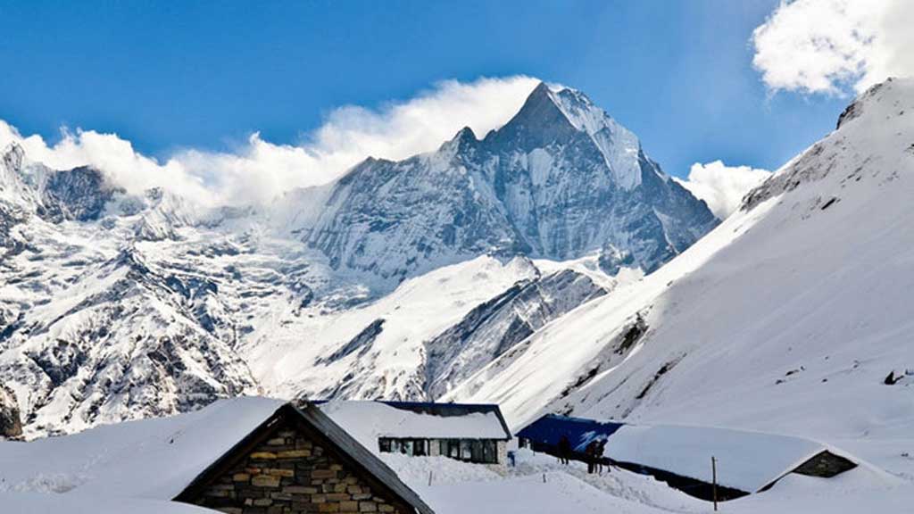
MACHHAPUCHHRE BASE CAMP (MBC-3,686 meters)
MBC has the excellence of being the bottom camp for a mountain that cannot be climbed. Most people will tell you that it is off limits because it is considered holy.
Though the holiness is historically based or a current construct is debatable. Either way, it doesn’t take away anything from the stunning location of the base camp. For the first time in the trek you will feel like you are among the mountains.
You will get to see another side of the mesmerizing mountain from here. Before you reach the lodges,there is also a German Metereological Station here .
FAQ’S
Where is Machhapuchhre Mountain?
How tall is Machhapuchhre Mountain?
Is Machhapuchhre Opened for climbing ?
Why is Machapuchare sacred?
Why is Mt machhapuchhre shaped like a fishtail?
How many mountains in Nepal are open for climbing?
What is the height of machhapuchhre?
[contact-form][contact-field label=”Name” type=”name” required=”true” /][contact-field label=”Email” type=”email” required=”true” /][contact-field label=”Website” type=”url” /][contact-field label=”Message” type=”textarea” /][/contact-form]
The post Mt Macchapuchhere :Is it Opened for climbing ? know it . appeared first on notes Nepal ,kantipur to unicode , kantipur unicode, translate kantipur to unicode, , kantipur to unicode converter, Unicode Preeti to Unicode Convertor,www.preeti to unicode, preeti to nepali unicode, preeti.
]]>The post Kathmandu Valley : History & its origin appeared first on notes Nepal ,kantipur to unicode , kantipur unicode, translate kantipur to unicode, , kantipur to unicode converter, Unicode Preeti to Unicode Convertor,www.preeti to unicode, preeti to nepali unicode, preeti.
]]>Until 1.5 million years ago, it was not a Kathmandu valley like it is now. Kathmandu Valley was a dense forest. If any human ancestor had come here to hunt, he would have met the elephant. That elephant was not as big as it is now. Was just a little bigger than us or our ancestors .According to geologists, the transformation of Kathmandu Valley began 1.5 million years ago, when friction between the Eurasian and Indian plates caused the Mahabharata mountain range to erupt to the south.
When the Bagmati was blocked and the ditch was filled with water, the dense forest here began to be submerged and destroyed. There was a commotion in the herd of animals. Clever animals may sting. Losses may have drowned while trying to make millions in Kathmandu valley. The fossils we have found are those of drowned animals.
Scientific studies have shown that the process of flooding of Khaldo started about 30,000 years ago. Two geographical disturbances may be responsible.
First, the frictional friction between the Eurasian and Indian plates that caused the Mahabharata mountain to rise to the south and form the Kathmandu Valley and freeze the lake, the constant friction of the same plate caused major earthquakes here in different periods.
For thousands of years, earthquakes shook the Valleys around the Kathmandu Valley. The gorges were cut, which became small and big bhanjyangs including Sanga, Pati (Sundarijal), Murkhu (Kakani), Gokarna, Pashupati, Bhimdhunga, Pharping and Naikap. The only geologist is of the opinion that water was drained from those bhanjyangs.
The water that has accumulated over millions of years has certainly not evaporated in a few thousand years. It is estimated that it took at least 20,000 years for the complete extinction. During this period, some gullies may have been torn by earthquakes, some may have been cut by water currents.
The fact that water was frozen in the Kathmandu Valley does not mean that it is full from the surface of the river below to the top of Chandragiri hill. There are many lakes, small, big, deep, lamcha, which have been drained in their own way at different times.
he longest lake-like terrain is the deep plain between the present Kathmandu, Patan and Bhaktapur regions.
This last remnant of Lake was excavated from Chobhar Gorge about 10,000 years ago, which is confirmed by scientific facts.Some things we can also understand from legends.
Origin of Kathmandu Valley
It is said that after Manjushree opened the water outlet by striking the Chobhar hill with a sword, it became suitable for human settlement in the Kathmandu valley. The knot of mystery that scientific research has not been able to solve is hidden in the legends.
We can also compare Manjushree’s sword attack with earthquakes of different periods. Why did Manjushri strike at Chobhar from the Yatra hills around the valley? Why not in Gokarna? Why not in Sanga? And didn’t Manjushri have to use a sword to cut the bhanjyang in Sundarijal and Kakani?
Our legend indicates that the last lake of Kathmandu Khaldo dried up and the Valley became habitable after the opening of Chobhar Danda.
The revelation of this story is that Kathmandu, which specializes in changing the form of ‘amoeba’, became a land suitable for human habitation at least 10,000 years ago by drying the water of the lake from the dense forest 1.5 million years ago in Valley
This is an interesting coincidence between Kathmandu story and human history.
At a time when the Kathmandu Valley was becoming habitable, our human ancestors were just learning to farm. They were making strides from the hunter-gatherer era to the agricultural era for millions of years.
They were trying to grow grain by mashing the forest. They were raising animals useful for milk, eggs and meat like cows, sheep, chickens and buffaloes. They were setting up permanent settlements in search of arable land along the river. From Egypt to Iran and from the United States to Africa, agriculture, animal husbandry, and systematic settlement were beginning .At such an important ‘turning point’ of human development, the Kathmandu Valley must have attracted a group of human beings wandering in search of a place to live .They rejoiced here, became here. Settled settlements, revived culture, created new states.Like a relay race, the kingdom passed from one ruler to another. Each ruler brought new art, new skills, skills and culture, architecture and style.The combination of all made Kathmandu a civilization.
The Licchavis have been expelled from Vaishali, India. Vaishali was ‘abbal’ in method, system and architecture in Kathmandu Valley. Their capital is near Patna in the Indian state of Bihar. India has been promoting Vaishali as the world’s ‘first republic’. According to Hindu architecture, this city-state, built in a square geometric pattern of nine-khanas, was surrounded by walls.
There were large wooden gates at the main entrances to the city. Lichchhavi remains are still abundant here, which are a tourist attraction.In the last year of Gautama Buddha’s life, in 486 BC, King Ajatashatru of Magadha attacked Vaishali. The Licchavis, who escaped with their lives, crossed the eastern part of India, climbed the forests of Madhes and reached Kathmandu Valley there .
How long could those who ruled a vast and prosperous empire like Vaishali stay away from Rajpath? One day, seeing the opportunity, he chased away all the Mallas, Gopal and others who ruled in different parts of the Kingdom of Nepal, including Kirant, and established their political supremacy and made Handigaun the capital. This is about the first century BC or the first century in Kathmandu Valley .
Whether it’s Athens in Greece or Rome in Italy, Luxor in Egypt, Damascus in Syria or Benares in India – there are many thousands of years old cities in the world. However, there are few ancient cities whose original form and structure have not changed. It is one of the rarest ancient cities in the world.
In terms of geography, this city, like the ‘Amoeba’, has preserved the rich Lichchavi-era urban crafts. It is now the responsibility of our generation to recognize Kathmandu Valley and make it known around the world.
The post Kathmandu Valley : History & its origin appeared first on notes Nepal ,kantipur to unicode , kantipur unicode, translate kantipur to unicode, , kantipur to unicode converter, Unicode Preeti to Unicode Convertor,www.preeti to unicode, preeti to nepali unicode, preeti.
]]>